
The exploratory work for the Alaska LNG is moving forward, both offshore and inland.
Crews performing geologic and geophysical research in the Nikiski area will be operating a barge offshore near Boulder Point and driving a vibroseis truck along Holt Lamplight Road to test for fault lines and folds below the surface.
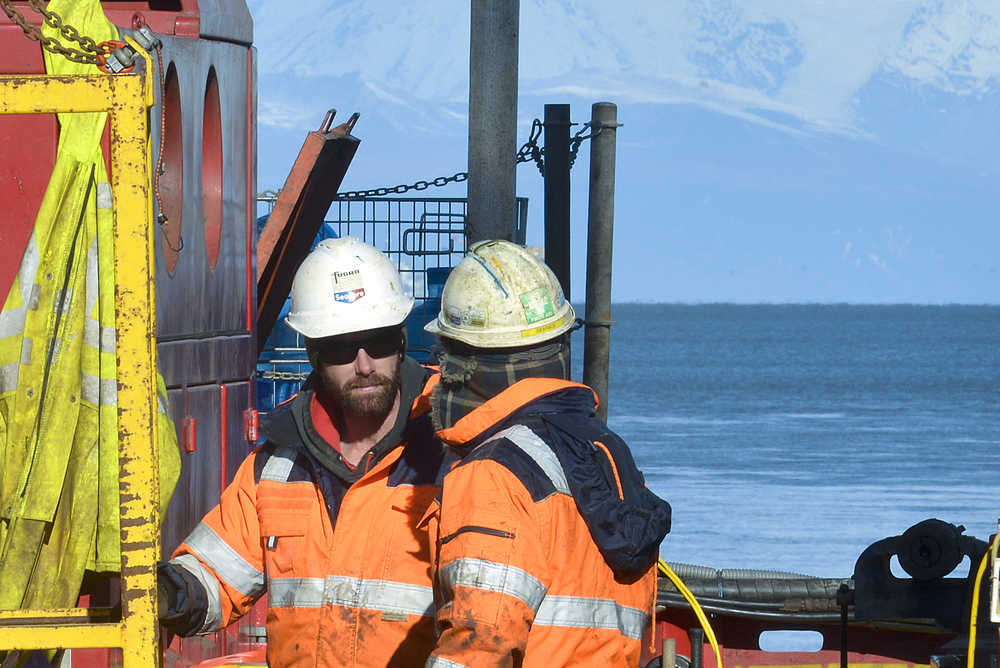
Since the beginning of August, workers for the project have been collecting data from the floor of Cook Inlet to establish more geographic information before the engineering plans for the pipeline are finalized. Working from a barge called a “jack-up” — named for the way it can lower itself to water level and rise back up its long legs — workers are taking core samples from the soil along the shore of the Kenai Peninsula.
“(The samples) are assessed for the soil properties,” said Jeff Raun, the environmental consultant for the project. “Why they need the information is to ensure that the proposed facility gets designed according to the conditions that there are here.”
The core samples will indicate what the soil on the floor of the inlet looks like and whether it is a good place to build, Raun said. To bring the machine on site, project coordinators had to obtain a number of approvals from regulatory agencies because Cook Inlet is home to beluga whales and fish species.
Because the scope of the project is still so wide, they plan to drill about 30 offshore boreholes in total, evaluating different options for the construction of the pipeline and the onshore facility. They have currently completed about 11, Raun said.
Fugro, the contractor performing the geological and geophysical surveys for the project, shipped in the jack-up rig and workers from the U.K., where the company’s marine-based operations headquarters are. Each borehole takes approximately a day to drill, but weather conditions limit when the barge can go out, according to Josselyn O’Connor, the community stakeholder adviser for the project.
The forecast for the project length is years, and there are already plans for multiple seasons of geologic and geophysical work, O’Connor said. Some of the future work includes underwater topography, called bathymetry, that will help the planners make a better informed decision about development in the inlet.
“This is a long, long project,” O’Connor said. “We’re already starting to look at next season’s outlook, what we’re going to need.”
In addition to the offshore work, Alaska LNG will also test for faults and folds beneath the surface on the land. Heavy trucks called vibroseis trucks, which have a high-pressure plate that drags along the road, will traverse an east-west route along Holt Lamplight Road beginning in the middle of next week, depending on weather and how long the crews take to lay the cable.
Neighbors will likely not feel the vibrations, though, Raun said. The vibrations echo down through the earth, bouncing from the bedrock and returning with sonic data about what lies beneath the surface. Cables with spaced accelerometers will be laid alongside the road to catch the vibrations, recording the data.
ConocoPhillips civil engineer Billy Oliver detailed the fieldwork during a recent community meeting in Nikiski. Besides taking more information about fault lines and folds in the earth, the accelerometers will collect seismic information that will help the project coordinators plan the best location for any development.
Although Oliver did not discuss what they had found so far, he said the data would be available to the community through the Federal Energy Regulatory Commission permitting process.
“If you’re standing close enough you can feel it, but by the time you get a little ways away, it’s all going way down in the ground,” Oliver said.
Most of the work will not involve flaggers, Raun said, but there will be workers out during daylight hours. Raun said he appreciated the community being patient during the work, both on land and offshore.
“We want them to know that we really appreciate their understanding,” Raun said.
Reach Elizabeth Earl at elizabeth.earl@peninsulaclarion.com.
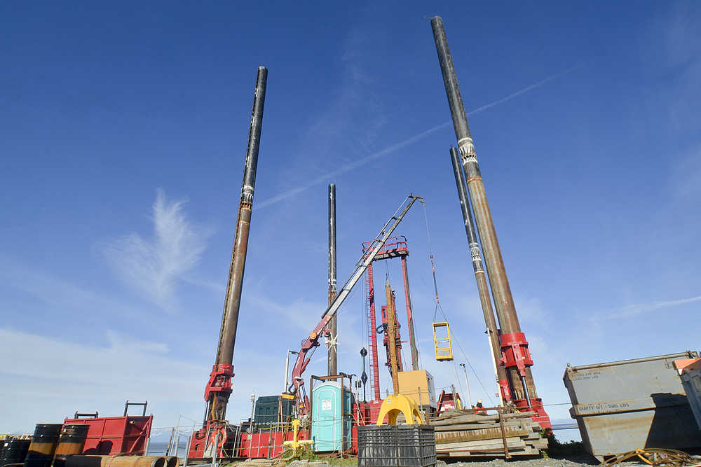
Photo by Rashah McChesney/Peninsula Clarion A jack-up rig used to sample the seabed near the proposed Alaska LNG plant marine terminal stands docked at the Rig Tenders Marine Terminal on Thursday Sept. 24, 2015 in Nikiski, Alaska.
