Editor’s note: This story has been changed to correct inaccurate statements of the width of the 30-foot cleared area above the Enstar pipeline and of the amount of rain that has fallen on the fire.
Fire managers have a new strategy for dealing with the East Fork wildfire burning in the Kenai National Wildlife Refuge near Sterling.
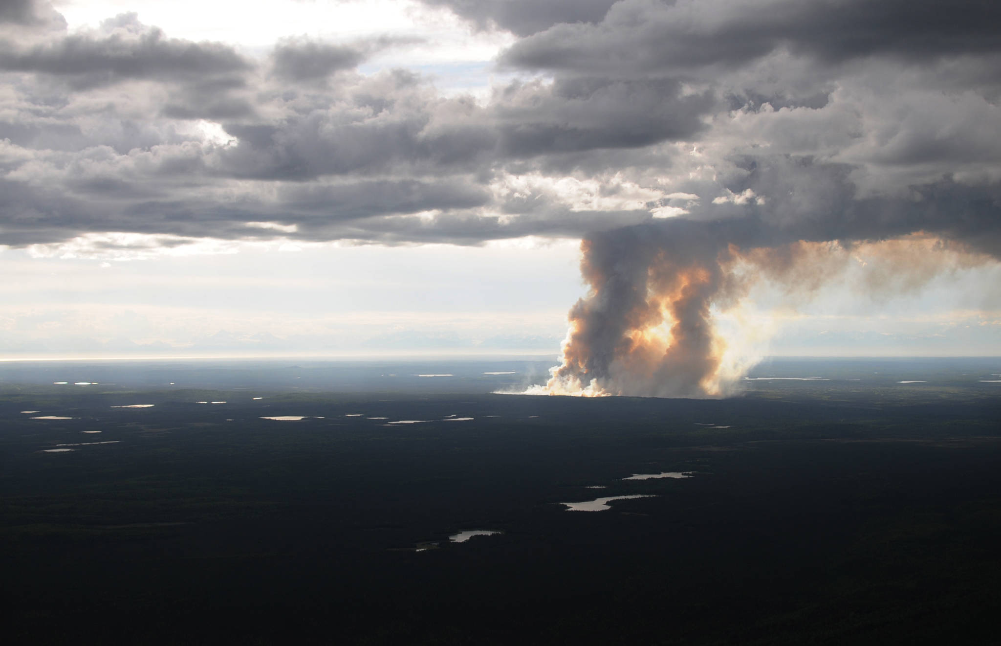
The fire, started by lightning last Thursday, was most recently estimated to be approximately 1,410 acres. The combination of smoke and cloud cover has been making it difficult to get an accurate estimate, said Alaska Division of Forestry Public Information Officer Celeste Prescott. The fire is still burning about 4.5 miles north of the Sterling Highway, according to a release from the division, which is coordinating with the U.S. Fish and Wildlife Service on the fire response.
The new management plan is to clean up a stand of black spruce trees near Sterling that “poses a constant threat to the nearest community,” according to the release. This is not a controlled burn, Prescott said, as those are premeditated and happen when there are no active fires.
“This started with an existing burn and this is a strategy to manage that existing burn,” she said.
Prescott said firefighters are currently working to cut a fuel break from the fire’s southwest perimeter about two and a half miles south to the east-west running Enstar natural gas pipeline. The underground pipeline is beneath a cleared corridor 30 feet wide that will also serves as a fire break, preventing the fire from spreading further south toward the Sterling Highway.
The planned clearing of the black spruce trees will have to wait for a few days until the area dries up enough for a successful, clean burn, Prescott said.
About 85 community members gathered for a public meeting in Sterling Monday night and were supportive of the management plan, Prescott said. Incident Commander John Glover of the Division of Forestry detailed the plan at the meeting.
Glover said the fire’s remoteness makes fighting it a more expensive task. The approximately 126 firefighters under his direction are working not on extinguishing the fire, but managing it to reduce the likelihood of more harmful fires in the future.
“We know we can’t get out there and safely and effectively move around without a massive utilization of people and equipment, and a lot of tax money,” Glover said. “So we’re trying to figure out a good plan to have a quality product to turn over to you guys after we leave.”
Once the fire is corralled to the south, it will be allowed to consume the area’s dense, continous stand of mature black spruce, an especially flammable tree that could fuel future fires. Depending on the weather, Glover said firefighters may also burn the fuel break to make it more clear.
“The thought behind it is: we have this fire here, we have personnel here actively trying to coral it and supress it and put in good fire breaks,” Glover said. “While we have these people here, since we’ve already spent that money and didn’t really have a choice in it, what good can we do for the community? Part of what we’ve established is that this fire started because of a lightening strike, and there’s a lot of receptive fuel out there, and not a lot of water. So what we’re looking at doing is a burn-out.”
Glover said the fire area is normally a dry spot in a rain shadow cast by the Chugach Mountains to the east, but lately has been wetter than usual — Prescott estimated Tuesday that the fire has gotten about a third of an inch of rain. If drier conditions emerge, Glover said his crew may start the burn as early as Wednesday. If not, the plan could be used later by other fire-preventing agencies.
Once the southern firebreak is finished, Glover said the fire would be allowed to burn to the northeast, further into the refuge away from inhabited areas. The Division of Forestry classifies much of the refuge land as a “limited suppression area” where its standard response would be to allow the burn while protecting any habitations in the area. Because of the fuel potential of the dry spruce forest between the fire and Sterling, responders decided to create the south-side breaks while letting the northern area burn.
Mike Hill, Assistant Fire Management Officer for the refuge, also spoke at Monday’s meeting about the Sterling fuel break, an 8.5 mile line of cleared land between 200 to 300 feet wide on the northern border between Sterling and the refuge intended to prevent fire from spreading into Sterling. The refuge and the six institutional land owners in the area began cutting the fuel break in late 2016 and finished this winter. Along with a smaller cleared area to the northwest and the natural break of the east fork Moose River, the Sterling fuel break is one of three barriers between Sterling and the fire, Hill said.
Hill said the fire break’s planners — the refuge, the Kenai Peninsula Borough, Cook Inlet Region, Inc., Alaska Mental Health Trust, Division of Forestry and Chugachmiut Incorporated— hope to extend the fire break to the Moose River in the near future.
A temporary flight restriction remains in place over the fire area, according to the Division of Forestry release. Two water-scooping aircraft based at the Kenai Municipal Airport are assigned to the fire, along with additional tankers elsewhere in the state. Three helicopters are also helping with water dumps and transporting personnel, according to the release.
Reach Megan Pacer at megan.pacer@peninsulaclarion.com. Reach Ben Boettger at ben.boettger@peninsulaclarion.com.

