
Invasive plants are now well known as a threat to ecosystem integrity across the Kenai Peninsula. We’ve watched the not-so-slow march of invasive species down the road system, dispersing seemingly faster each year. Wind-dispersed plants are of particular concern as their dispersal can be exponentially higher than for other nonnative plants. Hawkweeds, hawksbeard, dandelions, and now fall dandelion have become so common along our roadsides as to be virtually part of the “natural” landscape.
This trend of accepting potentially huge ecosystem changers as commonplace makes those of us involved in invasive species management ask a difficult but essential question — are we winning the war against invasive plants or merely holding the line? There is also the possibility — if we look at big picture trends — that we are failing miserably in our aim to contain, control or eradicate infestations.
Fortunately, on the Kenai National Wildlife Refuge, we have the means to get at this question. A large-scale systematic plot survey initiated in 2004, the LTEMP (Long Term Ecological Monitoring Program), revealed that only four percent of 256 plots had nonnative plant species. By observing what proportion of the Refuge remains composed of completely native flora over time, we can address our question at the landscape scale.
However, we also know that the nonnative plant community is mostly constrained (at least for now) to areas of the Refuge that have been disturbed by humans. So, working with Colorado State University in 2006, we inventoried native and nonnative flora on 74 plots that were established for the purpose of monitoring invasive plants on the Refuge’s human footprint. With the exception of a few remote public use cabins, the human footprint is mostly in the Skilak Lake area, the Swanson River and Swan Lake canoe systems, commercial oil and gas leases, the Refuge headquarters and Funny River Road area, and seismic lines spreading north of the Sterling Highway.
These plots were distributed in what is known as a stratified-random design where at least seven plots were randomly chosen for sampling within several disturbance types or strata: roads, campgrounds, seismic lines, right-of-ways, oil and gas well pads, and trails. These categories were further separated into fine-scale disturbances, such as developed versus undeveloped campgrounds.
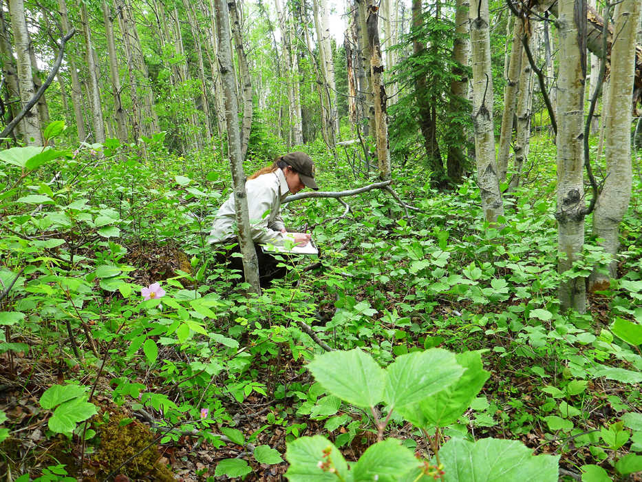
We resurveyed these plots this summer, 8 years after their initial measurements. We battled swarms of mosquitoes, slogged through bogs in the rain, and experienced a remarkable day of two flat tires. Once we even took an unplanned swim through a wetland to get to a plot. Finding the monument — metal discs affixed to rebar, often buried, moved or missing — was also a challenge. Throughout it all, even during the physically hard parts, we were buoyed by the new and unique vistas experienced each day, and the initial thrill of seeing what had changed since 2006.
The good news is that the distribution of invasive species hasn’t changed much within the human footprint. Nonnative plants occurred on more than 50 percent of the plots (38) in 2014, similar to 39 plots in 2006. The highest numbers of species were found on the oil and gas pads, followed by campgrounds and paved roadsides. The most common nonnative species were dandelion, clovers, Kentucky bluegrass, pineapple weed, bigleaf lupine and plantain.
Twenty invasive species were identified in 2014, down from 25 in 2006. Shepherd’s purse, narrowleaf hawkweed, oxeye daisy and red clover were found in 2006 but not in 2014. In contrast, lambsquarters and reed canarygrass were found in 2014 but not in 2006.
Some areas of within the human footprint are intrinsically more susceptible to invasion due to frequent vehicle or pedestrian traffic. The oil and gas infrastructure has been disturbed a lot recently with renewed interest in drilling and new ownership of leases. Roadsides are disturbed frequently by grading and by simply the annual passage of more than a million vehicles down the Sterling Highway. Visitors to trail heads and campgrounds inadvertently bring seeds with them. Nonetheless, we’ve been able to keep the spread in check due to a comprehensive herbicide treatment program that targets oil and gas well pads, campgrounds, trailheads and roadsides — gateways to the Refuge’s more pristine interior.
In contrast, plots on seismic lines showed little disturbance and virtually no invasion; some of the oldest lines from the 1950s and 1960s were barely discernable from surrounding vegetation. Most of these sites are rarely visited for any reason, and many were in wetlands. Future invasion is unlikely in these areas.
So are we winning the war? We appear to have mostly held the line on the Refuge over the past 8 years. The problem, however, is that by most counts we’re losing badly outside the Refuge with many invasives becoming well established in towns and rural subdivisions, and on the highway system outside the Refuge. Eight years from now, our resurvey of these plots will likely paint a very different picture. Although our surveys will continue to contribute to our understanding of patterns and chronology of invasions on the Refuge, smart strategies for combating invasives are necessary across land ownership boundaries if we are to really succeed on the Kenai Peninsula.
Dr. Elizabeth “Libby” Bella is the plant ecologist at the Kenai National Wildlife Refuge. Visit http://www.fws.gov/refuge/kenai/ for more information about the Refuge.
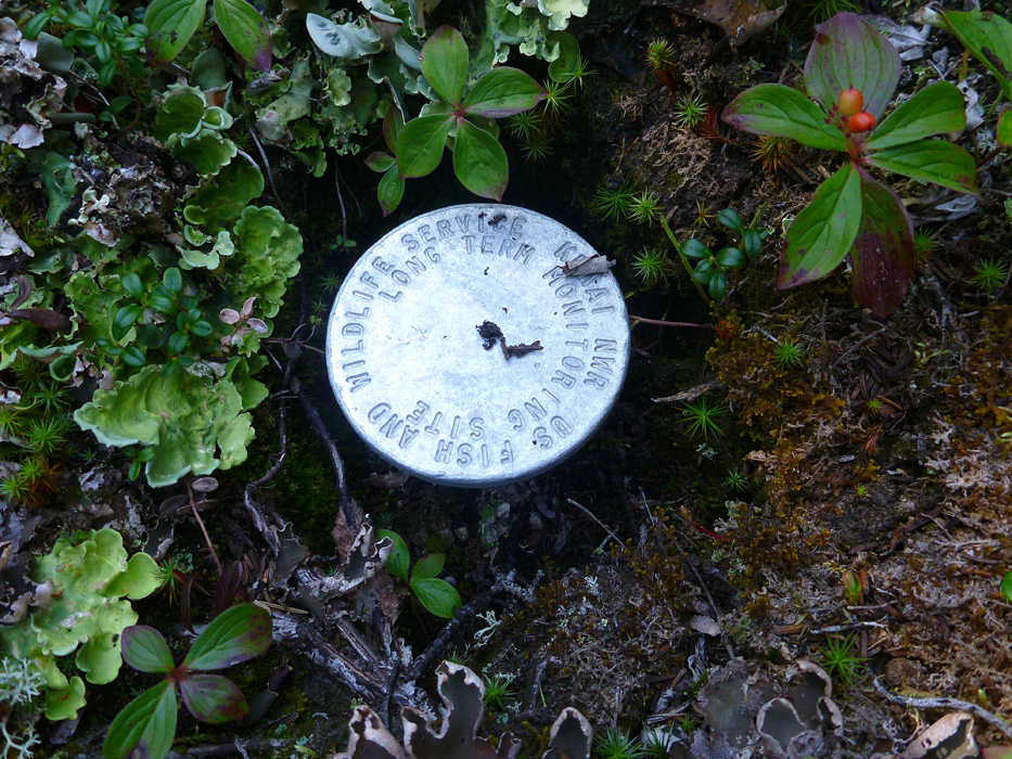
Finding a needle in a haystack: one of the permanent monuments put in place eight years ago to mark the location of 74 plots used to monitor invasive species populations on the Kenai National Wildlife Refuge. (Elizabeth Bella/Kenai National Wildlife Refuge)
