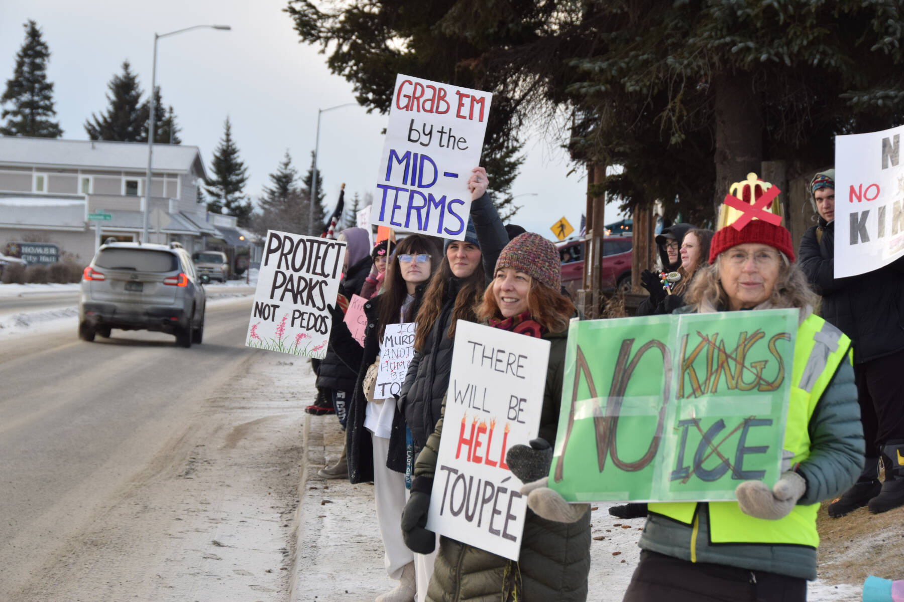
This screenshot from a project by University of Alaska Southeast postdoctoral researcher John Harley shows Alaska’s cities and census-designated places. Darker-colored areas on the map are communities with higher social vulnerability indices. (Screenshot)

This screenshot from a project by University of Alaska Southeast postdoctoral researcher John Harley shows Alaska’s cities and census-designated places. Darker-colored areas on the map are communities with higher social vulnerability indices. (Screenshot)

Researcher hopes map project can aid pandemic response

Work was done with Alaska in mind, but it could be adapted to other states and communities

Most maps of Alaska show governmental boundaries and geographic features, but offer little insight into where people live or which places might be especially vulnerable to pandemic or in need of relief.

A new project by John Harley, a postdoctoral researcher at the University of Alaska Southeast, attempts to show exactly that via an interactive map of the state that identifies the pockets of populations scattered throughout the state and identifies potentially at-risk areas using factors such as age, financial security and more.

“The census regions and blocks and block groups that the Census Bureau uses to kind of slice up the populations, those work pretty well in heavily populated areas,” Harley said. “But one of the stipulations of those areas is they have to fill in the entire area of the state, whereas in Alaska, you don’t have many people or any people living some pretty vast swaths of land. Having a social vulnerability index that’s calculated for this huge area —kind of like Northwestern Alaska —it’s not really representative of where people are actually living, so that was sort of one of the motivations. ”

ADVERTISEMENT
0 seconds of 0 secondsVolume 0%
Press shift question mark to access a list of keyboard shortcuts
00:00
00:00
00:00
 

Social vulnerability index is a measurement of a community’s vulnerability to stressors such as disease or natural disaster. The federal Centers for Disease Control calculates SVI using census data to help emergence response planners and public health officials identify places most likely to need support before, during and after a hazardous event.

Harley’s map, which is open-source so other states or communities could adapt it to their locale, allows users to apply filters to view the map in either traditional block groups or as a collection of more than 300 cities and census-designated places. The latter option essentially only displays the places people actually live.

[How the first week of schools went, according to school district staff]

Darker shades of blue on the map denote communities that are more at-risk to external stressors. Generally, Southeast Alaska, including City and Borough of Juneau, are a light shade of blue, as is Southcentral Alaska. The western edge of the state is comparatively much darker, and the North Slope is somewhere in between the shades.

The project was made possible by a $5,000 coronavirus response grant through University of Alaska Fairbanks’ Center for Innovation, Commercialization and Entrepreneurship.

Harley emphasized that the map is not yet ready to inform action. Instead, he hopes that now that his map exists, he can work with someone with a public health background to help it offer maximum public benefit.

“I have a data science background, and that’s kind of been my wheelhouse,” Harley said. “I don’t have a public health background, so it’d be great if we could collaborate on this, so someone from DHSS could come in and say ‘Hey, this looks great, let’s tweak it here and here, and then we can actually use this as a product going forward.’ And hopefully, they’d be able to use that for monitoring pandemic response, identifying vulnerable communities and planning distribution of resources that way. That’s my hope that DHSS will eventually pick up this tool.”

While Harley said while the map was born of the pandemic, it also has future applications, since social vulnerability indices are calculated to account for susceptibility to many maladies.

“Even once we hopefully conquer this current coronavirus pandemic, hopefully, this will still be useful,” Harley said.

• Contact Ben Hohenstatt at 907- 308-4895 or bhohenstatt@juneauempire.com. Follow him on Twitter at @BenHohenstatt.
More in News

Nathan Erfurth testifies in his own defense during his trial at the Kenai Courthouse in Kenai, Alaska, on Wednesday, July 30, 2025. (Jake Dye/Peninsula Clarion)
Erfurth found guilty on 28 counts for sex abuse, exploitation of a minor

The former Soldotna high school teacher and union head was convicted after six days of jury deliberations.

President Donald Trump and President Vladimir Putin of Russia during a joint news conference in Helsinki, Finland, July 16, 2018. President Trump is pushing to end the war in Ukraine, but analysts say the Russian leader could turn a hastily-planned meeting to his advantage. (Doug Mills/The New York Times)
Trump to meet Putin at Joint Base Elmendorf-Richardson in Anchorage

Trump was expected to make what amounted to a day trip to Alaska to meet with Putin.

Civil Air Patrol Cadet 1st Lt. Hugh Traugott (right) works with Cadet Airman First Class Audrey Crocker (left) during a statewide training exercise on disaster response on Aug. 9-10, 2025, in Homer, Alaska.
Civil Air Patrol practices disaster response

Homer cadets and senior members were part of a statewide exercise last weekend.

Kenai Peninsula Borough Assembly president, Peter Ribbens, speaks in an aside to District 8 representative and Vice President Kelly Cooper before the beginning of the Aug. 5, 2025, KPB Assembly meeting at the Porcupine Theater in Homer, Alaska. (Chloe Pleznac/Homer News)
Voters to decide on borough sales tax cap increase

Assembly Ordinance 2025-14 aims to adjust the sales tax cap with inflation.

A voter fills out their ballot at the Kenai No. 2 Precinct in the Challenger Learning Center of Alaska in Kenai, Alaska, on Tuesday, Oct. 1, 2024. (Jake Dye/Peninsula Clarion)
Few candidates have filed for upcoming election

The filing period for candidacy applications across all six electoral races closes at 4:30 p.m. on Friday, Aug. 15.

President Zen Kelly speaks during a meeting of the Kenai Peninsula Borough School District’s Board of Education in Soldotna, Alaska, on Monday, May 5, 2025. (Jake Dye/Peninsula Clarion)
KPBSD reverses some activity stipend cuts, raises fees

The district’s final budget adopted in July called for a halving of all activity stipends.

Joel Johnson, president of the National Marine Sanctuary Foundation; Carrie Hourman, lead sustainability director for Dow Climate & Circularity; and Susan Sherman, executive director of the Marine Debris Foundation, sit for a panel at the Kenai River Sportfishing Association’s Kenai Classic Roundtable at the Soldotna Regional Sports Complex in Soldotna, Alaska, on Wednesday, Aug. 21, 2024. (Jake Dye/Peninsula Clarion)
Annual Kenai Classic Roundtable to focus on Alaska king salmon

The event will be held from noon to 3 p.m. on Wednesday, Aug. 20, in the Soldotna Field House.

Kenai City Hall is seen on a sunny Thursday, June 5, 2025, in Kenai, Alaska. (Jake Dye/Peninsula Clarion)
Kenai to inventory roads, streetlights

The projects will identify the condition of the respective city infrastructure and identify possible “major deficiencies,” officials said.

The Soldotna Field House is seen on a sunny Monday, March 31, 2025, in Soldotna, Alaska. (Jake Dye/Peninsula Clarion)
Grand opening for Soldotna Field House on Saturday

Though the field house will be opened this weekend, it will not open to general public operations for a couple more weeks.

Most Read