
“I remember it quite clearly,” said Cindy Buchanan, who was only 8 years old in 1964 when the magnitude 9.2 Good Friday Earthquake struck Alaska. Buchanan was at home with her 3-year-old brother when the ground began to shake their A-frame house in Eagle River.
“It was the noise that I remember so much: the creaking of the house, the crashing of the dishes falling and books falling to the floor, and just the roar because that earthquake went on for so long,” she said. “I swear I could hear the roar of the avalanches down the mountains. I remember that almost more than anything.”
It’s a similar noise she recalled hearing last Wednesday, July 28, when the United State’s largest earthquake in 50 years struck, rattling the Land’s End Resort where Buchanan and her sister, Lara Hildreth, were staying. The magnitude 8.2 earthquake struck 64 miles southeast of Perryville and shook Alaska’s Gulf Coast around 10:15 p.m., resulting in aftershocks and tsunami warnings for many communities, including Homer, Seldovia and Seward. The tsunami warning eventually was canceled at about 12:30 a.m. Thursday.
“It was unlike any other earthquake I’d ever been in,” Buchanan said. “There wasn’t the jolting or shaking back and forth, but the whole building was rolling.”
According to the Alaska Earthquake Center, the July 28 earthquake occurred in the Alaska-Aleutian subduction zone where the Pacific and North American tectonic plates converge.
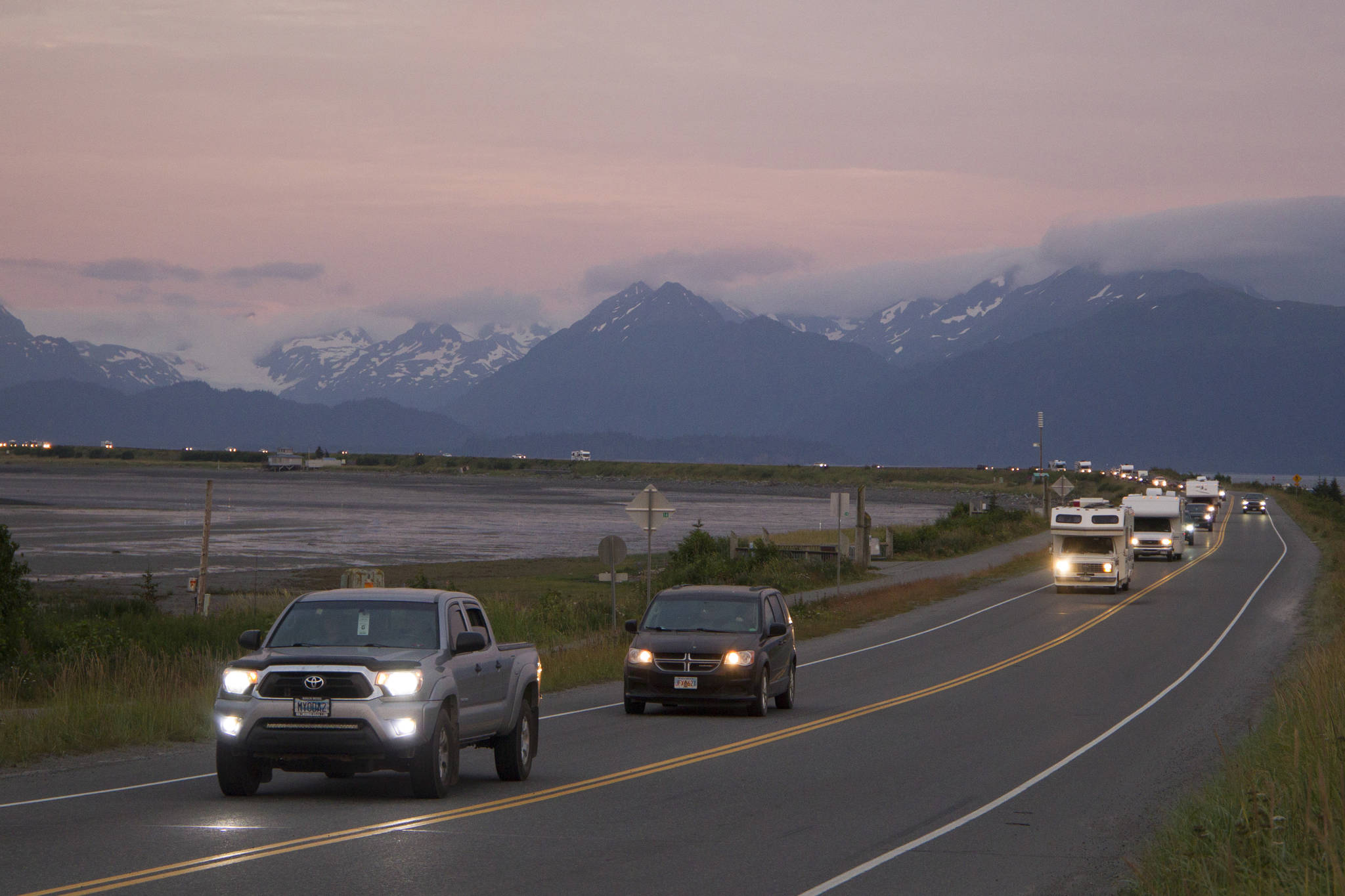
The earthquake surprised the sisters with how long it lasted. Once the building stopped “rolling,” it wasn’t long until the tsunami sirens started blaring evacuation warnings. Knowing they were in the last place anyone should be when a tsunami warning sounds, Buchanan said there was never a question as to if they were going to evacuate or not. They quickly grabbed their essential belongings and started walking.
“When we realized we were on the Spit, which is not a great place to be when there is a potential tsunami, we took it very seriously,” Hildreth said. “… When the sirens went off, that’s when it really hit home.”
Without a car in which to evacuate, Buchanan and Hildreth were uncertain of how they would get away from the danger being on the Homer Spit presented in that moment. A couple passing by showed compassion for the duo and drove them to a childhood friend’s house on Skyline Drive, past the inundation zone.
“It was really an awful feeling, to be honest, to kind of not know how you were going to get off the Spit,” Buchanan said. “It was scary. I didn’t realize it until we got into the car that my legs were shaking.”
“I find that I have this ability in an emergency that I’m pretty calm and clear-headed even though I’m scared,” Buchanan added. “I did even at 8.”
Having lived through the Good Friday Earthquake as well as the July 28 earthquake and with many in between, Buchanan says she always remembers the impact the first earthquake had on her. She has learned the importance of being prepared for potential emergencies, including familiarizing herself with emergency protocols, being prepared for aftershocks, having a go-bag in case of quick evacuations and staying calm.
“Every time an earthquake hits, it takes me back to (1964) because I’m always wondering if it will get that intense,” Buchanan said.
Now living in Seattle and having retired from a 25-year preschool teacher career, Buchanan writes poetry about her experiences, including her realization of the power of the earth through the Good Friday Earthquake. While she and her family made it out predominantly unscathed, she knew and knew of people who died that day. Seeing the aftermath in Anchorage frightened the 8-year-old Buchanan, and she says she is thankful they were safe once her parents made it home.
“It is something that lingers and lasts, the stories from people who were involved,” Buchanan said. “I am very aware of how lucky we all were.”
Dr. Kasey Aderhold, a seismologist at the Incorporated Research Institutions for Seismology and a Homer resident, explained earthquakes of such large magnitudes like last Wednesday and in 1964 rupture in this area because of the power and massive size of the two faults. These earthquakes occur on what’s called the Alaska-Aleutian megathrust, which is a massive fault formed as the Pacific plate subducts, or descends, below the North American plate, Aderhold explained.
“When plates are descending like that, they don’t do it perfectly smoothly. They can get stuck on each other, but the plate itself is still moving, so the strain is building up at that stuck place. Once it overcomes, there is enough of that strain building up, it can rupture in an earthquake,” Aderhold said. “Because this is from a plate that is subducting or descending, you have a dip in that fault. It’s not straight up and down, it’s dipping, and because of that dip at a subduction megathrust like this, it allows for really large fault surface area to get stuck and then rupture in a very large earthquake.”
As the largest U.S. earthquake in 50 years, the July 28 earthquake, Aderhold said, was significant because it did not have a major impact on the epicenter’s surroundings and it provides additional data for researchers to investigate.
“It’s nice to have larger things like this that can teach us about earthquakes and their behaviors along these hazardous faults without having an impact to people, aside from a pretty restless night for some,” she said.
While earthquakes along the Alaska-Aleutian megathrust are expected, Aderhold said the area’s previous large earthquakes reaching magnitudes of more than 9.0 are cause for additional observation from seismologists.
“With every earthquake, there is always the potential for it to be followed by something larger than itself,” Aderhold said.
Aftershocks are still happening near the epicenter of the last earthquake, so Aderhold encourages everyone to review local earthquake and tsunami emergency protocols and to understand that another earthquake, tsunami or even a triggered landslide could occur.
“We live in an active world, and the ground beneath our feet doesn’t have to stay as stable as we’d like it to be,” Aderhold said.
She also recommended shakeout.org for additional earthquake readiness information and training.
In addition to earthquake preparedness training, City of Homer Public Information Officer and Special Projects & Communications Coordinator Jenny Carroll encouraged all tourists and locals to familiarize themselves with Homer’s evacuation and emergency plans, which can be found at https://www.cityofhomer-ak.gov/emergency-information/be-tsunami-aware-be-tsunami-prepared-know-homers-evacuation-routes-and-safe.
“We are here as a resource,” Carroll said. “We’re really willing to help people understand where to go and what to do. My office can take those calls, and as people need particular help, I can help them find where they need to go and what they need to do.”
Homer’s maximum inundation level is at 50 feet above sea level, and people should evacuate to areas above the Sterling Highway for safety. The Homer “blue line,” or 50-foot sea level line, was redrawn in 2019 by the Alaska Earthquake Center, and while there is not a physical marker for the line, Carroll said identifying the locations is a future goal of the city.
Evacuation signs are in essential locations, helping direct traffic in the midst of an emergency like last Wednesday. If residing in the inundation zone, including the Homer Spit, Ocean Drive and parts of Beluga Slough and Sterling Highway, evacuation routes are different depending on the location north or south of Beluga Slough, Carroll explained.
“What we ask people to do is drive off the spit, and if you’re south of Beluga Slough, you would turn right on Kachemak Drive and continue all the way out to East End Road,” Carroll said. “What I would encourage anybody who lives north of Beluga Slough and are in the inundation zone is to go up above Sterling Highway and find accommodations with friends or a public place to park.”
Homer High School currently serves as the tsunami evacuation shelter. Carroll urged people to not go to South Peninsula Hospital.
While earthquakes and tsunami warnings are a common occurrence when residing in Alaska, Buchanan, Aderhold and Carroll warned people about becoming complacent and ignoring warning sirens to evacuate.
“Even though we’ve had many warnings and no event, the last thing you want to do is to not take the (warnings) seriously,” Carroll said.
For more information or to see if your residence is in the inundation zone, visit https://www.cityofhomer-ak.gov/emergency-information/be-tsunami-aware-be-tsunami-prepared-know-homers-evacuation-routes-and-safe or contact the City Manager’s office at 907-235-8121.
Reach Sarah Knapp at sarah.knapp@homernews.com.
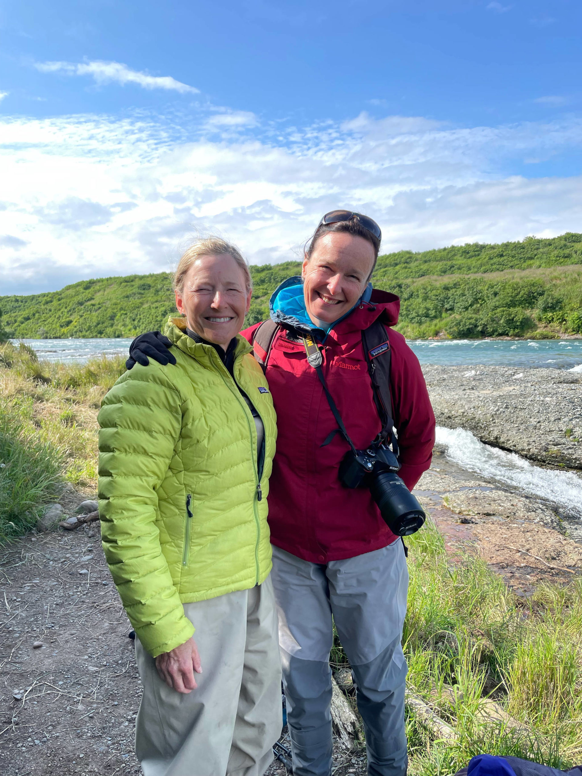
Cindy Buchanan (left) and Lara Hildreth (right) were in Homer after a trip to McNeil River State Game Sanctuary and Refuge when the July 28 magnitude 8.2 earthquake struck. (Photo provided by Cindy Buchanan)
