Kenai airport rezoned
Published 4:22 am Friday, May 27, 2016
Kenai’s airport land belongs to a new zone — the airport light industrial zone, designated for airport-related uses such as hangars, aircraft sales and repair facilities, and aviation-related manufacturing and storage.
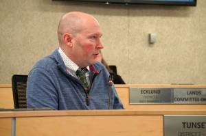
The council unanimously created the zone at its May 18 meeting and added 51 parcels of land to it. The decision to add the parcels was opposed by council members Bob Molloy and Mike Boyle. Council member Terry Bookey was absent.
Council member Henry Knackstedt proposed rezoning the airport in May 2015. Most of the land inside Kenai’s airport reserve had been zoned “conservation” since the land had been granted to the city from the federal government in 1963. Knackstedt has said in previous interviews that the meaning of conservation in that context is that the land was conserved for airport use, not for an ecological purpose.
Knackstedt cited the ambiguous meaning of “conservation” as one of his reasons for requesting a rezone. The rezone plan was subsequently created by city administrators and approved by the Planning and Zoning and Airport commissions.
According to the ordinance that created it, the airport light industrial zone is meant to “protect the viability of the Kenai Municipal Airport as a resource to the community by encouraging compatible land uses, densities, and reducing hazards that may endanger the lives and properties of the public and aviation users.”
It allows “industrial and commercial uses which are usually compatible with aviation users … which have no nuisance effects upon surrounding property.”
At the May 18 meeting, Malloy proposed several amendments to the zone-creating ordinance, many of which were about buffers between the new zone and surrounding areas. The Kenai airport borders a neighborhood on its southwestern edge, near Floatplane Road.
The ordinance specifies that where airport light industrial and residential land meet, the two “shall be screened by a sight-obscuring eight-foot high fence or vegetation of good appearance” and prohibits uses that create dust, smoke, noise, fumes or light glare in surrounding properties.
It does not mention buffers, a word Molloy moved to define as part of a property “established as an open space for the purpose of screening or separating properties to minimize or remediate the impacts between land uses.”
Council members Tim Navarre, Henry Knackstedt and Brian Gabriel and Mayor Pat Porter voted successfully against adding Molloy’s buffer definition to the ordinance, as well as against Molloy’s amendment stating that the city should establish buffers “to support development and to minimize or remediate the impacts of airport-related development upon surrounding land uses.”
Molloy’s amendment to list buffers as border-area requirements alongside vegetation and sight-obscuring fences was also defeated on a motion by Knackstedt, with Molloy and Boyle voting to the keep the buffer requirement.
After the new zone was created, the council added 51 properties to it, which had previously been belonged to the conservation, suburban and rural residential, and light industrial zones. All the land added to the new zone came from within the airport boundary.
Molloy moved to postpone the land-designation vote until the council’s next meeting because the land-use table included in the rezoning ordinance wasn’t the one currently in effect — it lacked the recent additions of commercial marijuana uses.
“Because we don’t have a land use table with commercial marijuana uses, what was the recommendation for this zone as to those uses?” Molloy asked. “Did the commission deal with that?”
Molloy said the council should use an updated land-use table, including the marijuana allowances, when it votes on adding the land.
“There’s no time rush on this — it’s just a matter of best practice,” Molloy said. “This zone is going to be created, and the two weeks to do it right isn’t going to harm anyone in the city or anyone at all.”
The land was added to the new zone with Molloy and Boyle opposing.
Airport buffers were the subject of another ordinance the council unanimously passed at the May 18 meeting, allowing the city to purchase property bordering the airport to use as a buffer.
The creation of buffers between the airport and residential areas is a recommendation of the airport master plan, a set of Federal Aviation Administration-required development rules currently being updated by the airport commission.
Reach Ben Boettger at ben.boettger@cmg-northwest2.go-vip.net/peninsulaclarion.