Eyes in the sky: Funny River Fire hightlights potential for unmanned aircraft
Published 5:53 am Wednesday, June 18, 2014


As the Funny River Horse Trail wildfire inched closer to town, Matt Parker spent his nights in an open field battling mosquitoes and hugging a horse for warmth while assisting in the unmanned aircraft systems missions to map the wildfire.
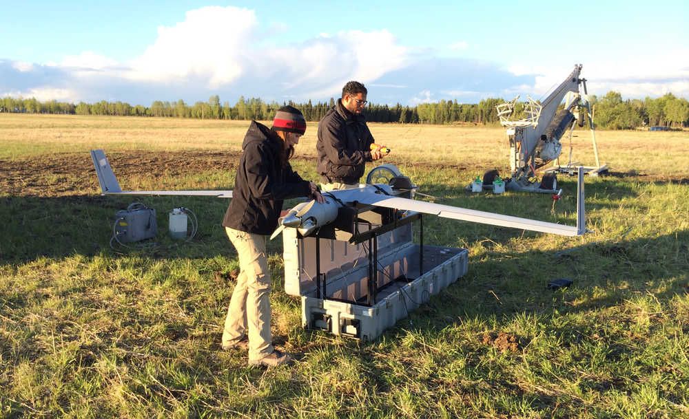
Parker is the Director of Unmanned Aircraft Systems at Precision Integrated that flies, maintains and operates UAVs. Parker and his team flew to Alaska to aid Marty Rogers, Director of the Alaska Center for Unmanned Aircraft Systems Integration at University of Alaska Fairbanks.
The Funny River Horse Trail wildfire, first reported on May 19, is currently at 195,858 aces, and is 60 percent contained, according to the Alaska Division of Forestry.
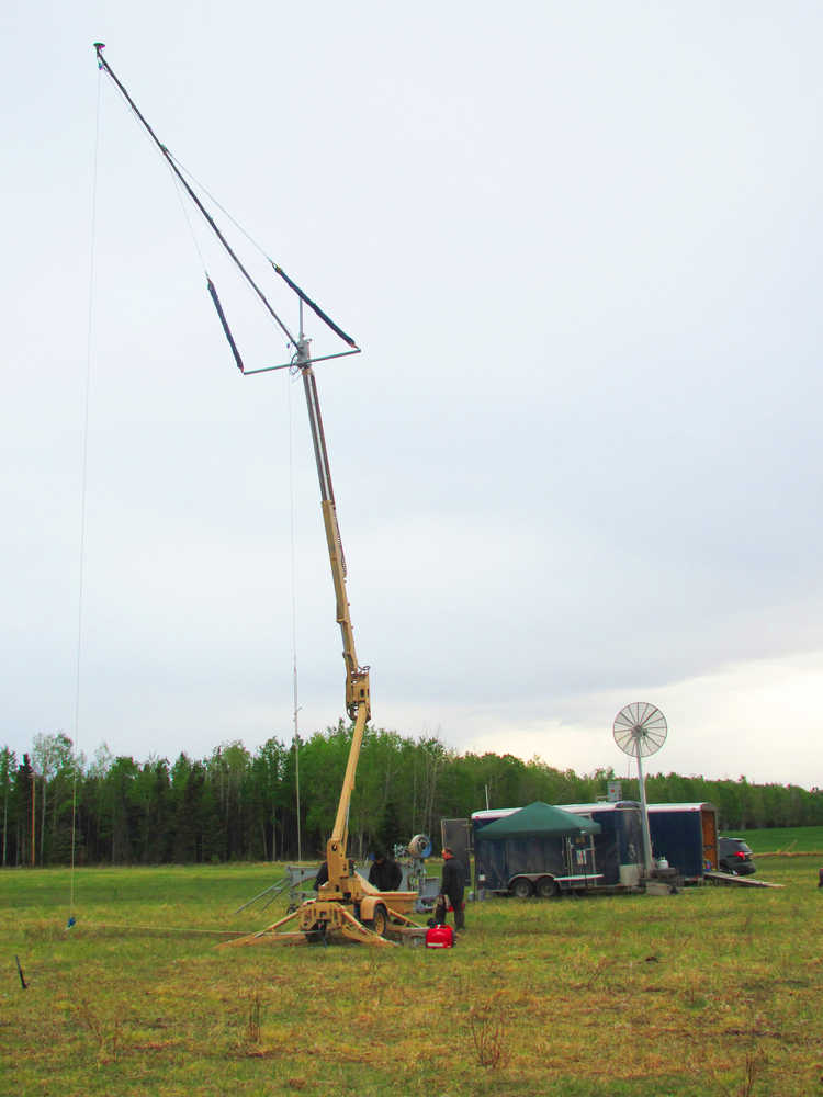
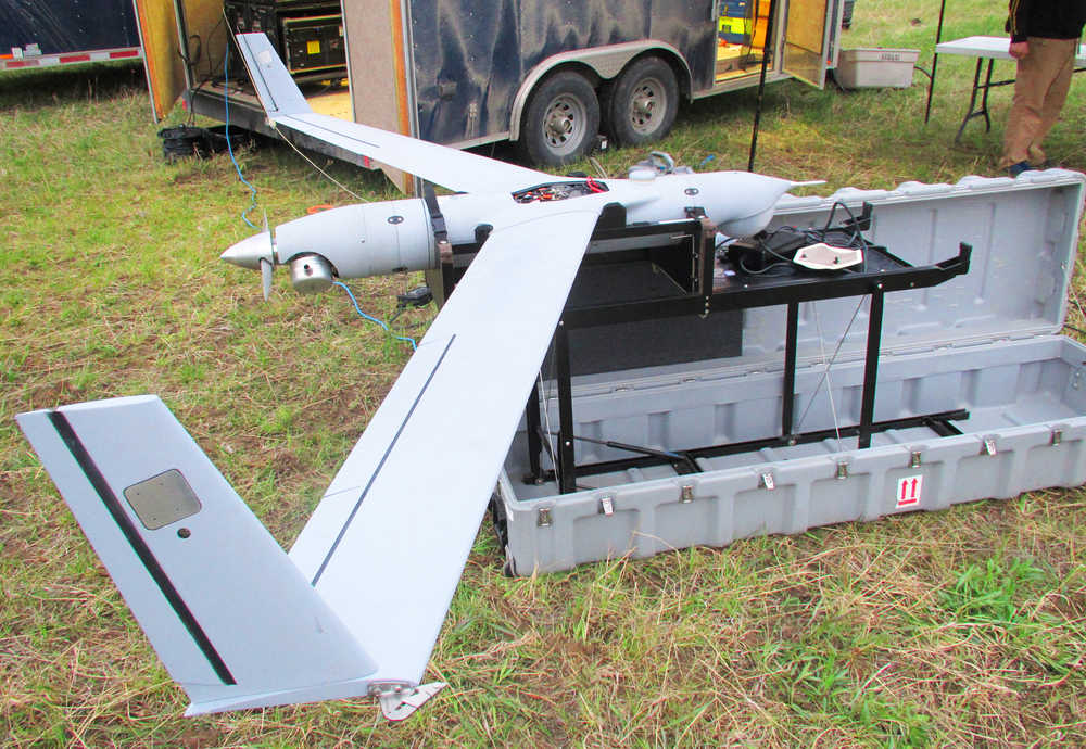
Rogers led the collaboration of teams that deployed an Insitu ScanEagle containing an infrared camera for recognizing hotspots on the perimeter of the wildfire. Insitu is a Boeing subsidiary.
Parker said his team supported Rogers’ execution of five sorties over the course of a week. Shifts began at 8 p.m. and sometimes lasted 26 hours straight, he said.
Together they were able locate 100 hotspots, said Rayjan Wilson, senior systems engineer at ASUASI.
Wilson said he was responsible for a pivotal component for the missions. Once on location, Wilson designed a software program that translated the GPS points of the infrared images retrieved by the ScanEagle into readable data in a matter of hours.
“Think of translating something from Spanish to English,” Wilson said.
When an area was spotted holding a higher temperature than the surrounding area on the infrared camera, an image would be taken, Wilson said.
In one instance a bear was interpreted as a hotspot, Rogers said.
In another, a lake was indentified, Wilson said. Resolution of the camera equipment caused the misidentifications.
Each morning the teams provided the information to the Alaska Division of Forestry, Wilson said.
The Alaska Interagency Incident Management Team used the information for decision-making regarding where to focus firefighting efforts the following day, said spokesman Terry Anderson said.
Anderson worked on the Rim Fire, in California in August 2013, where the California Air National Guard deployed an MQ-1 Predator to help map and provide real time images of the wildfire.
Civilian controlled UAV missions have a long ways to go before funding and regulations catch up with the military’s arsenal supporting UAV humanitarian missions, Division of Forestry Air Operations Supervisor Ty Miller said.
“It is a step toward the future,” Miller said. “I am very optimistic.”
Whatever the human mind can imagine is a possibility for the use of UAV technology, Miller said.
In the weeks following the Funny River Horse Trail fire Rogers traveled from Alaska to Washington, D.C., to Iceland to Spain for worldwide meetings on the fast-evolving technology of unmanned aircraft.
One hurdle that was made apparent during the Funny River Horse Trail wildfire, was a lack of regulations in place for operating manned and unmanned vehicles in the same airspace, Rogers said.
While working on the edge of the Funny River Horse Trail wildfire, the UAV flew at night because the central Kenai Peninsula airspace is clear of manned aircraft after 11 p.m., Rogers said.
While the ACUASI program has existed for a decade, Alaska’s UAV industry is minimally developed, Wilson said. No instate companies manufacture parts for the repurposed military vehicles, he said.
However, the possibilities for non-conflict UAV use are vast, Parker said.
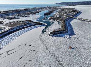
Parker advocated using UAVs for rescue efforts and conservation, Wilson proposed taking ash samples of erupting volcanoes to monitor where the plumes are headed and watching ice flows in the Arctic. Rogers suggested tracking animal populations.
Significant technological developments, funding and regulations need to be addressed, but the Funny River Fire Horse Trail wildfire was another step toward non-conflict operations of UAVs, Wilson said.
In the end it won’t be about the UAVs, but the data they can collect, Wilson said.
Kelly Sullivan can be reached at kelly.sullivan@cmg-northwest2.go-vip.net/peninsulaclarion.