
It must have been an alarming sight to see these two Kenai Peninsula rivers temporarily flow backward into the outlets of Kenai and Tustumena Lakes. But it also had been a most disturbing day.
That evening (5:36 p.m.) on Good Friday, March 27, 1964 the great Alaskan Earthquake struck Southcentral Alaska. It was the strongest earthquake (9.2 on the Movement Magnitude Scale) measured in North America and the second strongest in the world, surpassed only by the 9.5 Valdivia earthquake off the coast of Chile on May 22, 1960.
For comparison, the destructive earthquakes off the east coast of Japan (2011) and west coast of Sumatra (2004) were both 9.1 earthquakes. The Great Alaskan Earthquake lasted four minutes and thirty-eight seconds compared to the recent January 23, 2018 earthquake off the coast of Kodiak, which seemed to last a long time, but lasted only about a minute and was registered at 7.9. The 1964 earthquake was a destructive subduction zone quake where two tectonic plates converge. The 2018 Kodiak earthquake was a strike-slip quake, which is less destructive, caused by horizontal motion across a fault.
Of the many destructive effects of the Great 1964 Alaskan Earthquake, the temporary reversals of flow of the Kenai River out of Kenai Lake and the Kasilof River out of Tustumena Lake were relatively benign from a human damage perspective. Reports later published by the U.S. Geological Survey attributed the temporary change in the direction of flow to the tilting of the basins of Kenai and Tustumena lakes, both of which were frozen at the time. The tilting of the lake basins, about three feet at Kenai Lake and a foot or less at Tustumena Lake, caused the water in the lakes to slosh back and forth (seiching), temporarily reversing the flow of the rivers at the mouths of both lakes.
According to the above reports, several witnesses saw the Kenai River reverse and flow back into the outlet of Kenai Lake. One witness, John Ingram of Cooper Landing, could see logs on the bottom of Kenai Lake and the Kenai River rapidly rushing back into Kenai Lake. The lake level was later estimated to have temporarily dropped 15 feet. Damage to trees along the shoreline from the sloshing water extended to about 30 feet above the lake level.
Flow in the Kasilof River was so low after the earthquake that it almost ran dry. The late Joe Secora, then living at the upper end of Tustumena Lake, reported that the lake level rose and fell for about two hours after the earthquake as the water sloshed back and forth in the basin. The day following the earthquake, a biologist from the Alaska Department of Fish and Game reported he was able to walk in its channel wearing only overshoes.
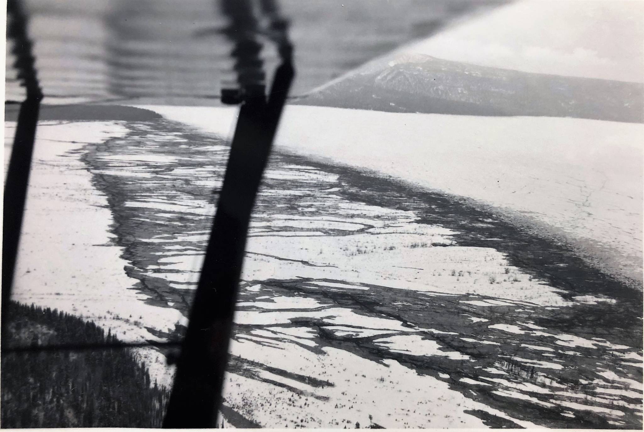
A photograph of upper Tustumena Lake taken a couple of days later by Ave Thayer, Assistant Refuge Manager and pilot of the then Kenai National Moose Range, shows where water and sand erupted out of fissures in the outwash delta at the head of the lake. Later in June, the late Joe Magargl from Kasilof, reported the level of Tustumena Lake was well below normal seasonal levels. By late autumn 1964, it was estimated to be five feet below normal level.
One effect of the earthquake on the Refuge’s fish and wildlife occurred when the sloshing of water and ice back and forth in frozen lowland lakes destroyed beaver lodges and bank dens or left them exposed above the water line. Water levels in the Finger Lakes area dropped about five feet. Such abrupt changes undoubtedly affected resident fish populations. Faults and fissures occurred in the ground throughout the Refuge. One such fissure can still be seen 54 years later on the trail to Silver Lake near the trailhead.
A later (1993) radiocarbon study, which dated layers of buried organic material in the Kenai and Kasilof River Flats, Chickaloon Bay and other similar sites in the Cook Inlet region, suggested that in the past 5,000 years there have been six to nine major subsistence events associated with major, probably great, earthquakes. This gives an average reoccurance interval of roughly 600 to 800 years between major earthquakes, but this is only an average. Who knows for certain when the next big earthquake may happen?
Dr. Ted Bailey, supervisory wildlife biologist at Kenai National Wildlife Refuge before retiring in 2001, has lived on the Kenai Peninsula for over 40 years. Find more information about Kenai Refuge at http://kenai.fws.gov or http://www.facebook.com/kenainationalwildliferefuge.
