
Trivia question: What does the 2014 Funny River fire and 2015 Card Street fire have in common? If you guessed both were human-caused and spotted across the Kenai River, that’s correct but not the answer I’m looking for. If you guessed that both were controlled (at least in part) by prior vegetation treatments, you are correct! So what does this have to do with the community of Sterling?
As the Card Street fire spread east of Sterling, onto the Kenai National Wildlife Refuge, and then jumped Skilak Lake Road, it intercepted a change in vegetation. The dense and continuous black spruce stand it was burning gave way to an open area Refuge staff had mechanically treated in 2009, and beyond this an area of mixed woods previously treated in 1984 primarily to improve moose habitat. Both treatments changed the fire behavior from a running fire in the tree crowns to a less intense surface fire that firefighters could actually engage with to stop its northward spread. Had those two changes in vegetation type not been there, the fire would have continued to spread east and north, possibly jumping the Sterling Highway and impacting several additional properties northeast of Sterling.
The best available science was utilized to determine the wildfire risk in this area, commonly referred to as the Wildland-Urban Interface. Vegetation types, typical weather scenarios, and the proximity of values at risk are all key inputs for the Interagency Fuels Treatment Decision Support System (IFTDSS). This web-based data integration software provides fire managers with a more efficient and effective framework for fuels treatment planning and analysis. The models rated Sterling as being at a high risk based on the surrounding vegetation’s potential to burn, especially along the northeast corner of the community. To reinforce these findings, the Sterling Community Wildfire Protection Plan also identifies this hazard and the need to mitigate associated wildfire risk.
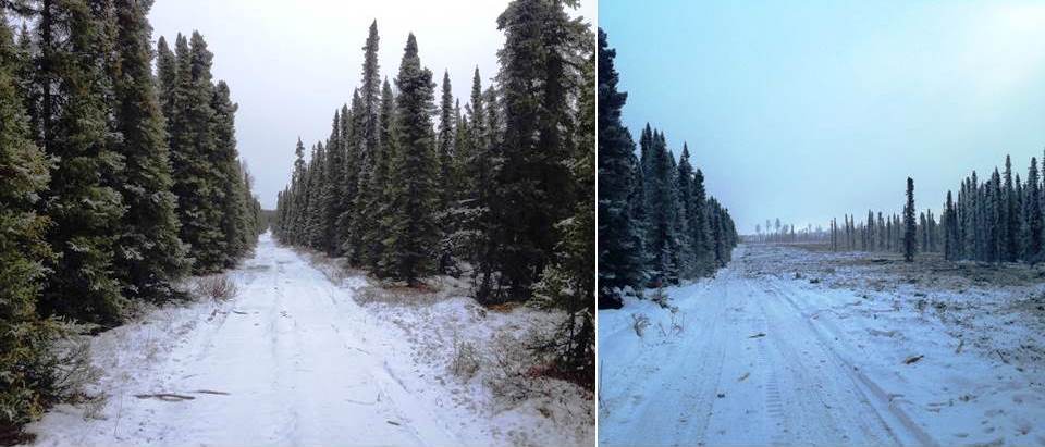
Largely due to the success of previous fuel treatments, the Kenai Refuge received funding to plan and begin implementation of a fuel break near Sterling. The IFTDSS outputs were utilized to prioritize where to start. This was also at a time when the Refuge fire program had reduced personnel. Fortunately, staff from the Kenai-Kodiak Area Division of Forestry (DOF) stepped up to assist. Through a cooperative agreement, DOF will be able to use Refuge funding to plan and treat fuels over the next 3 years. The first of these was just completed in December, and consists of 124 acres on over 5 ½ miles of ground (see photos). Additional funding was provided by the Alaska Department of Fish &Game (ADF&G).
While the cooperative agreement was being drafted, additional partners joined the efforts: Chugachmiut Incorporated, Cook Inlet Regional Incorporated (CIRI), and the Kenai Peninsula Borough (KPB) joined Kenai Refuge, DOF, and ADF&G. All six cooperators combined resources with the goal of treating approximately 250 acres of vegetation with mechanical treatments, hand thinning, and prescribed fire over the next few years.
The planned fuel break starts on Refuge lands 1/10 mile north of the Sterling Highway at milepost 76, runs north for 2 ½ miles, then runs west towards Swanson River Road for 6 miles. The fuel break is not contiguous, but is broken into sections on a variety of land ownerships and utilizes natural openings or existing man-made barriers that would already influence fire spread whenever possible. In addition to the 124 acres on CIRI and KPB lands, over 20 acres of mastication and hand-thinned treatments were completed on Refuge lands adjacent to Three Johns Road, with more planned in the upcoming months.
Other than the reduction of wildfire risk to communities, what are the added benefits of these strategically placed fuel breaks? As was mentioned with the Card Street and Funny River fires, they substantially improve the safety of responding firefighters by moving the fire out of the crowns down to the surface therefore reducing the overall fire intensity. Additionally, the decrease in risk helps to increase the decision space for management of new wildland fires, while providing opportunities to utilize fire’s role as a natural process to maintain and improve habitats through the restoration of forest succession. Lastly, these fuel breaks cannot stop a wildfire on their own; it is increasingly important for local residents to employ Firewise principles on their property to fully mitigate the hazards posed by wildfires (often coined the “one-two” punch).
But the story does not end here….anywhere there is hazardous vegetation (fuels) there is a risk of wildfire impacts to lives and property. The Kenai Peninsula Fuel Break Working Group, a subset of the “Interagency All Lands All Hands Action Plan” has been formed to proactively advance this concept for other vulnerable communities on the Peninsula. This group is currently looking westward from Sterling, so stay tuned for more.
Kristi Bulock is the Fire Management Officer at Kenai National Wildlife Refuge. Find more information about the Refuge at http://www.fws.gov/refuge/kenai/ or http://www.facebook.com/kenainationalwildliferefuge.
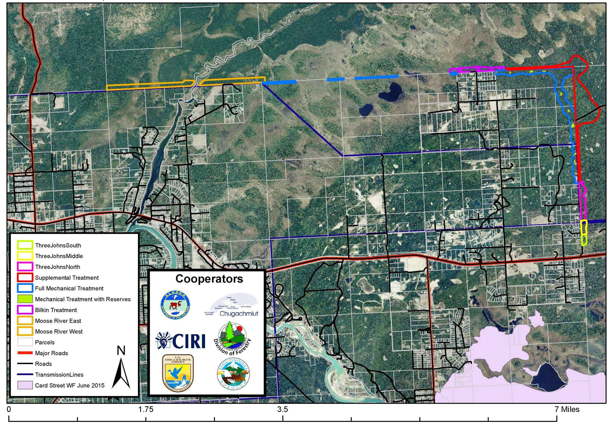
The fuel break wraps around the northeast corner of Sterling and straddles the Moose River. (Graphic courtesy Kenai National Wildlife Refuge)
