
FORT BENTON, Mont. (AP) — Just down river from Fort Benton stands Signal Point.
The knob along the Missouri River is made up of glacier till, deposited during multiple periods in geologic history when much of the area was covered in glaciers.
Signal Point is several miles from the Missouri River Interpretive Center in Fort Benton and also likely several miles from the nearest ranger. But thanks to a new EarthCache trail, floaters still can learn about the geology of the site as if they were floating with a ranger or geologist.
The Missouri River Interpretive Center recently launched an EarthCache trail, featuring 19 EarthCache sites through the Upper Missouri Breaks.
The Wild and Scenic Stretch of the Missouri River, from Fort Benton to James Kipp Recreation Area, is full of amazing geology. However, floating alone, miles from the nearest ranger, it can be difficult for visitors to learn about that geology.
That was part of the inspiration behind the new Upper Missouri River EarthCache Trail, said Connie Jacobs, director of the BLM Missouri Breaks Interpretive Center, who helped developed the trail.
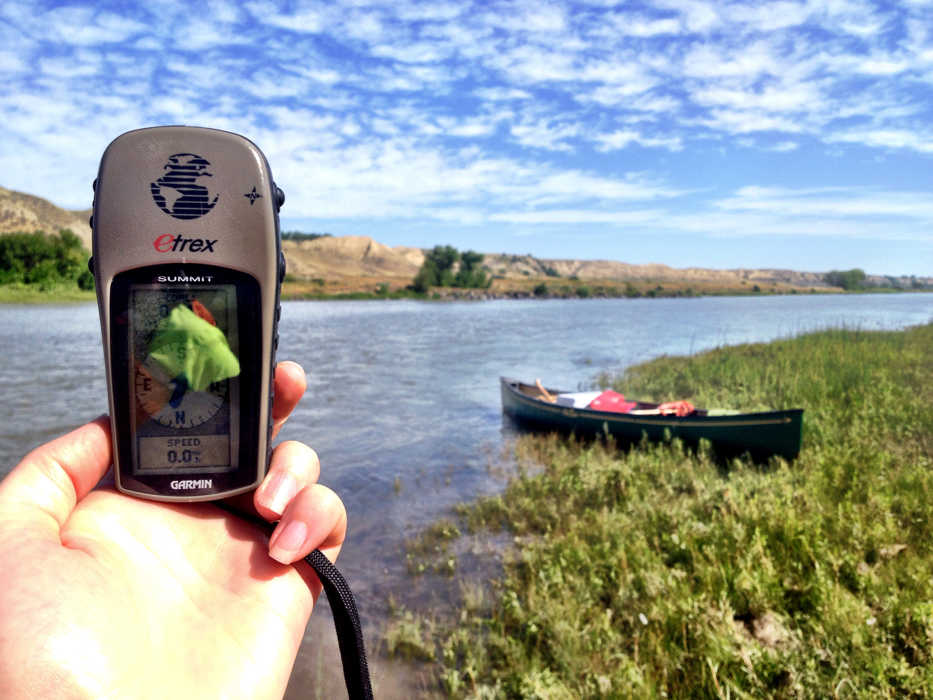
EarthCaches are similar to geocaches. Both can be found via GPS coordinates. While geocaches lead searchers to a container of some sort where they can sign their name on a log, EarthCaches lead people to a geological feature.
“EarthCache sites are much more educational,” Jacobs said. “It takes you to a unique geological feature.”
Before leaving on a river float, people can download EarthCache information, including GPS coordinates of where the sites are located. Then, when they reach one of the sites, they can read about the geology from the information they downloaded ahead of time.
That allows visitors to be miles away from a ranger and still learn about the landscape, said Ramia Bashara, a GeoCorps intern through the Geological Society of America who helped develop the EarthCache Trail.
“There are no tangible things you actually obtain,” Bashara explained about EathCaches.
And there’s no physical log to sign. Instead, EarthCachers get credit for visiting a site by proving they were there.
“You have to answer a question that you can’t answer unless you go there,” Jacobs said.
In the case of Signal Point, visitors read about glacial till and glacial cycles. The glacial deposits at Signal Point were accumulated 2.5 million years ago or less and are pale yellowish-brown, light olive-gray or brownish-gray. In between glacial deposits are alluvial deposits.
So to prove they were there, visitors have to answer this question: “How many different types of deposits do you see in Signal Point?”
Other sites on the trail feature reverse faults, fossil beds and clinker beds, which are coal beds that have been struck by lightning.
“This is a very interesting geological phenomenon,” Bashara said of clinker beds.
Jacobs has worked for several years to develop the Upper Missouri River EarthCache Trail. Every summer since 2007, she’s had a GeoCorps intern work on the trail, picking sites and developing the information to go with them.
“These caches are really meant to be a little enjoyable way to enhance someone’s trip,” Jacobs said.
Seeing these geological features on the land is different than learning about them in a book or at the interpretive center.
“You can have a basic geology lesson when you’re floating down the river,” Bashara said.
And each site teaches visitors about something they can look for throughout the float.
The sites included on the Upper Missouri River EarthCache Trail, along with EarthCache sites worldwide, are listed on GeoCaching.com. Before leaving on a float trip, those interested in looking for the EarthCaches can print information on EarthCache sites.
The information also can be accessed from a smartphone. However, most of the sites on the EarthCache trail are outside cell service. All of the sites, except for one, on the Upper Missouri River EarthCache Trail are accessible only by boat.
After stopping at Signal Point on a recent day, a group of floaters continued downstream to the next EarthCache site.
At that site, they read about bank erosion.
“Geologically speaking, erosion is the gradual breakdown of earth materials by the action of wind, water and other natural agents,” the EarthCache material reads. “Rivers erode land to create valleys. The Missouri River has been eroding this landscape for millions of years.”
It is one example of how dynamic the Missouri River is, said Mary Ellen Ergle, of the Lewis and Clark Interpretive Center, who was floating that day.
“You totally get to see geology in action in a landscape like this,” she said.
The EarthCache material discusses different types of bank erosion, such as undercutting, sloughing, attrition and abrasion. Then it asks visitors, “What geologic term describes what’s happening to the banks at Evan’s Bend Primitive Campground?”
So what is happening at Even’s Bend? Follow the EarthCache trail and see for yourself.
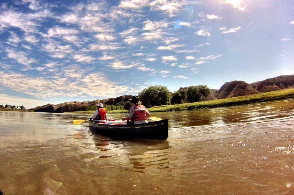
In a Sept. 3, 2014 photo, floaters look for EarthCache sites on the Missouri River near Fort Benton, Mont. The Upper Missouri Breaks Interpretive Center recently established an EarthCache trail along the Wild and Scenic Upper Missouri River.(AP Photo/Great Falls Tribune, Erin Madison)
