
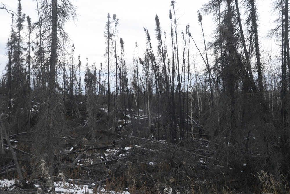
When last summer’s 8,000-acre Card Street wildfire tore through parts of the Kenai National Wildlife Refuge and looked like it might threaten the Sterling Highway, refuge managers made a call to prevent potential threat to human lives. They had a bulldozer line put into the refuge in the Skilak Lake Recreation Area to prevent the fire from moving north toward the highway or heading back toward Sterling.
Normally a jagged scar on the natural landscape visible for years, this particular dozer line is being reproposed into a source of recreation and education for refuge users in the form of Marsh Lake Trail.
Refuge Manager Andy Loranger said U.S. Fish and Wildlife staff had planned for a hiking trail in the dozer line’s general location as part of the Skilak Lake Recreation Area’s management plan. Specifically, he said the plan called for the area to be targeted for improvements to existing hiking trails and development of new trails.
“That area was also looked at as a place where we would be doing some wildlife treatments,” he said.
Some clearing work to that extent was completed in 2010 and 2011, Loranger said, to promote vegetation growth and provide better browse for moose. Refuge staff had hoped to do some prescribed burns in the recreation area to go along with the management plan.
“It took care of that for us,” Loranger said of the Card Street fire.
Refuge staff had the bulldozer line made on higher elevation during the wildfire so as to reduce the impact to wetlands, he said.
“As we looked at that dozer line from the air … it just struck me, you know, wouldn’t this make an outstanding hiking trail?” Loranger said.
And so work began, even as the Card Street fire raged on, to prepare that bulldozer line for its future purpose. Handwork was done earlier this year by high school students through the Student Conservation Association, said Visitor Services Manager Matt Conner.
The students camped out at the Lower Skilak Lake Campground for several weeks as they worked to fill in the dozer line at the end of the trail where it meets the lake, Conner said. The line stops about 200 yards from the lake, so the students used gravel fill to extend the path all the way to the water, he said.
“They used huge tree stumps … to make parallel sideboards, if you will,” Conner said.
Work will pause for now as winter is on its way, Conner said, but the refuge will pick it up again in the spring and continue as funds and staff become available.
“At the trail head itself we plan to develop a parking area,” Loranger said.
Perhaps the most unique part of the trail due to its start as a dozer line will be the educational elements refuge staff plan to add along it. Incorporated into the trail will be information explaining the relationship between wildfires and the ecology of the refuge lands, Conner and Loranger said. Essentially, it will tell the story of Card Street and is in a location where hikers will be able to see the effects of the fire, and later, regrowth.
“Fire has a natural process in the ecosystem,” Conner said. “A fire, when it happens naturally, has an impact both beneficial and sometimes negative.”
Card Street is a prime example of this, Conner said, as it prompted refuge staff to stop its natural progression as soon as it threatened lives and structures.
“Out of that emerged a beautiful thing,” he said.
While unfinished, the trail is open to hike.
Reach Megan Pacer at megan.pacer@peninsulaclarion.com.
