
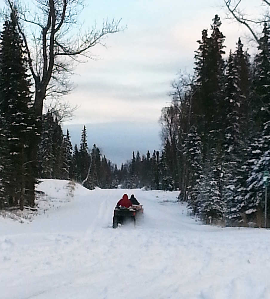
Once the pavement ends past Mile 39 of the Kenai Spur Highway at Captain Cook State Park, an all-terrain vehicle trail continues along the Tyonek pipelines through the wetlands. A mile into the trail is a creek that is not navigable by vehicle. In the summer months the wetlands are too swampy to travel and in the winter when the ground is frozen, ATV tire tracks have left deep ruts, said Nikiski resident Keith Gerke.
“Because of all the water hazards out there in the summer, I don’t go because its so tore up,” Gerke said. “I’m glad we have snow and all the bumps can get packed down and I can snowmachine out there.”
While the Kenai Peninsula Borough’s north road extension project has been on hold as administration awaits approval to bypass an environmental impact statement, Apache is in the design process to construct a road of similar design for oil and gas exploration on Tyonek owned-land.
Apache has applied to the borough road service area to construct a 7.5-mile road extension that would continue from the end of the Spur Highway from Captain Cook State Park to Otter Creek in the Gray Cliffs subdivision.
About 40 people attended a community meeting held by Apache Tuesday at the Nikiski Recreation Center as representatives informed the public about the project and answered questions. Apache sent a letter out to property owners to inform them of their intentions, said Apache spokesperson Lisa Parker.
John Hendrix, Apache Alaska Corporation General Manager said the proposed road is a “great opportunity” for Apache and the Kenai Peninsula.
“We are looking for a gateway into native lands,” he said. “We want to make this work for everybody.”
Parker said Apache has applied for permits with the U.S. Army Corps of Engineers. Because road construction would be undertaken on wetlands, the company is working with the corps to complete a federal Clean Water Act Section 404 wetlands permit.
Borough Road Service Area Director Pat Malone said the board approved the design at the Nov. 18 meeting, but has not signed off on the extension until Apache’s wetlands permit is approved. The Corps evaluates permit applications for all construction activities that occur in the nation’s waters, including wetlands.
“Anytime a project involves fill to be placed in wetlands you need to talk to Corps,” he said. “It’s Apache’s show until they get to the next stage.”
Apache project manager Tim Brandenburg said the road traverses the existing Spur right-of-way, which has been in place since the 1980’s. The road would be 50 feet closer to the inlet than the existing trail along the pipelines, he said.
The proposed road design calls for an 18-foot wide driving surface with 10-foot wide pullouts roughly every quarter mile. The pullouts would be constructed at areas with hills and curves. The upland section would use a 24-inch gravel embankment over geotextile, while the wetland sections would be increased to 30-inches over geogrid.
Apache has hired McLane Engineering in Soldotna to design the road, which is similar to the half-mile extension Nordaq Energy added in 2012. The proposed road would extend another 7.8 miles into the platted Gray Cliffs subdivision. The road would not cross Otter Creek but continue down Mountain Violet Drive for nearly a mile and have a 400-foot by 170-foot turnaround area at the end.
Parker estimated if the permits were approved which she expects a decision by the end of the week, there would then be a 30-day public comment period. Afterwards, work to clear the area could start in February 2015 with an estimated completion date by October 2016.
At the meeting, some area property owners were given the opportunity to ask questions and express concerns of the impacts the road would have for the remote area.
Janice Chumley with the University of Fairbanks Cooperative Extension asked what invasive plant management plans are in place for putting a road in an ecologically sensitive area that has previously not been disturbed.
McLane consultant Gina DeBardelaben said any work done on the Kenai National Wildlife Refuge requires everyone to follow certain weed management practices. Material sites would be inspected for invasive species and any equipment brought on site would be power washed, she said.
Parker said the project is in the planning stages and no material site or contractors have been selected.
Under federal law, the Department of the Interior, which manages wildlife refuges, must grant Alaska Native Corporations access to lands they own within refuges but can set terms and conditions for access to minimize environmental effects.
Parker said Apache is in the middle of corporate budgeting and are hoping to obtain funding for the project. She said because their endeavor is to pay for the road with private money, they are confident the project would be approved before the borough, who have more than $5 million in federal money earmarked for the road project.
“If our project goes forward, the borough can take the money they still have and allocate to another project,” Parker said.
In 1998, the borough received $5.2 million from the federal government to construct a 26-mile extension to Point Possession. In 2004, an environmental assessment indicated an EIS would be required before the project could go forward.
In February, Borough Mayor Mike Navarre discussed a scaled down scope of the project that would extend the road four miles to Jacob’s Ladder beach assess, which would mitigate damage done to the wetlands on the corridor, said Borough Chief of Staff Paul Ostrander.
The borough received a recommendation from the Alaska Department of Transportation to obtain a categorical exclusion, which would eliminate the need to conduct additional environmental studies.
In September, the borough sent letters of support for the project from the Department of Fish and Game, Kenai National Wildlife Refuge, Corps of Engineers and Kenai Watershed Forum to the Federal Highway Administration. Ostrander said the project couldn’t move forward until they receive a categorical exclusion.
Ostrander said if Apache gets approved to construct the road it would make the borough’s north road extension project redundant.
“We would look at a way to utilize the borough money in north road and repurpose in a different way,” he said. “In the last 18 months our process has been to work toward the categorical exclusion. We want to utilize the funds as originally intended.”
Apache has conducted seismic survey operations in the Gray Cliffs area throughout October. The work was staged out of Nikiski with helicopters transporting crews and equipment to the area. Parker said planning for the road has been ongoing for about six months since geologists identified potential places to drill.
“We will build it but this will be a public road,” Hendrix said.
Century 21 realtor Fred Braun said there are about 700 parcels between the two subdivisions. Several property owners expressed interest in a parking lot at the end of the proposed road.
Anchorage resident Fran Wold said she hasn’t been to her property in the Gray Cliffs subdivision in six years. Wold has 69 acres of land she purchased in 1982 when the Kenai Peninsula sold land. As she gets older, she said it is difficult to make the trip to her recreational cabin. She said a lot of people would access their property from the beach and climb the bluff.
Nikiski resident Tim O’Brien has property at the end of Moose Point about 14 miles past the end of the road. He said when his father purchased land in the area from the borough in 1982, they were told they would have to wait patiently before a road could be build. While his father never was able to get to his property O’Brien said he supported the road extension because as he gets older it is more difficult to access the area.
“I’m behind you guys (Apache) 100 percent,” he said. “I hope you get the road project to go.”
O’Brien and several other residents expressed concerns that the road would also have negative consequences of security for their properties.
“Development does bring vandalism,” O’Brien said.
Gerke, who owns property in the Gray Cliffs area for recreation, said he likes to go out there to get away from the industrial plants in Nikiski. He said he is considering moving out of Nikiski because the growing industry is getting too busy. Gerke had concerns if Apache did find oil they would build up infrastructure and develop separation facilities in the remote area.
“I like the idea of having a road,” he said. “We enjoy peace and quiet out there and the views are incredible. I don’t want to be out there listening to plant rumbling but I guess that’s progress so we have to accept it.”
Reach Dan Balmer at daniel.balmer@peninsulaclarion.com
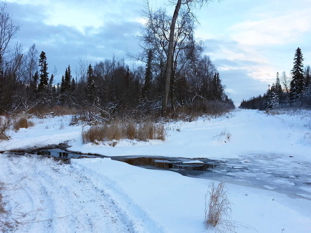
Photo by Dan Balmer/Peninsula Clarion A creek less than a mile into the trail on the Kenai Spur right-of-way to the Gray Cliffs and Moose Point subdivisions north of Captain Cook State Park. Apache Corp. has proposed to construct a 7.5 mile road extension to Otter Creek for oil and gas exploration on Tyonek Native Corporation land and are waiting for approval from the US Army Corps of Engineers on their wetlands permit before the road project could proceed.
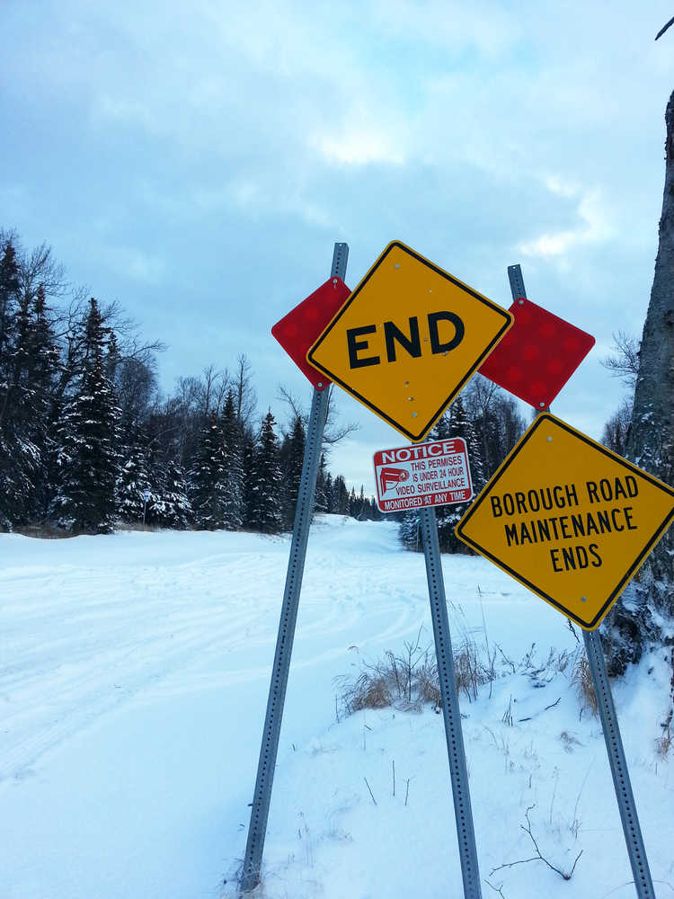
Photo by Dan Balmer/Peninsula Clarion The end of the Kenai Spur Highway at Captain Cook State Park is the start of a trail that goes out to the Gray Cliffs and Moose Point subdivisions. Apache Alaska Corporation revealed plans at a Nikiski community meeting Tuesday to construct a road extension 7.5 miles to Gray Cliffs subdivision for oil and gas exploration.
